A Computational Framework For Animal Aided Design

Navn
Andrew Thomas Smith
Uddannelsesgrad
Kandidat
Fagfelt
Arkitektur
Institut
Bygningskunst og Teknologi
Program
Computation in Architecture
År
2023


Increasing the accessibility and usability of ecological data for the early phases of an architectural project


Summary:

PLANimal explores how open-source geospatial ecological data can be accessibly generated, queried, structured, and ultimately drive early-stage conceptual design decisions by leveraging the collective specialist knowledge of citizens, scientists, and designers. Based on Animal-Aided-Design and Biodiversity Sensitive Urban Design principles, PLANimal is both a framework, a web platform, and a case study.


Abstract:

Urban development has crucial direct and indirect impacts on biodiversity. Unfortunately, the architects, planners, and developers who shape our urban environments don’t often consider the impact architectural-scale design decisions have on a given site’s wildlife ecology. Understanding and predicting the ecological consequences of architectural-scale design decisions will be increasingly important to sustainable urban development, and to reduce its negative impacts on global biodiversity. Current architectural modeling platforms enable architects to design and coordinate high-fidelity geometric building information models. However, design-for construction workflows and their associated software environments are slow to incorporate the capacity for considering non-anthropocentric, “soft” ecological information in this process. Broadly, the goal of this project is to develop a computational interface  incorporates gathering and modeling ecological information and evaluating how design decisions might influence this model. Due to a short time-frame, the specific focus of this project is limited to surveying and modeling ecological conditions of limited to central Copenhagen as they relate to species of plants, fungi, and particularly animals. Three primary methods are deployed in this project. First, a web-based interface will connect and extend beyond the capabilities of Rhino and Grasshopper to retrieve, model, visualize, and coordinate ecological data. Second, a web-based map will help users gather and standardize several ecological geospatial datasets for enriching the ecological model. And finally, the platform will be used to test the PLANimal framework through a design case study looking the ecology of the Refshaleoen district of Copenhagen at an architectural and urban scale.


Context: Biodiversity Decline
1
/7
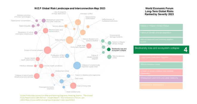
Biodiversity collapse is growing long-term threat to our planet
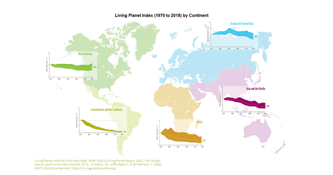
Biodiversity decline is occurring on all continents
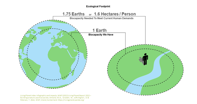
Our ecological footprint is the primary cause of biodiversity decline
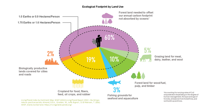
Measuring our ecological footprint by land use is an effective way in identifying impacts on biodiversity
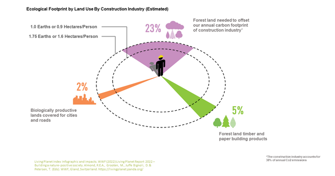
The AEC industry is responsible for approximately one third of our global annual ecological footprint by land use
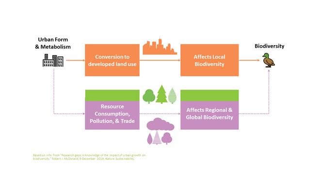
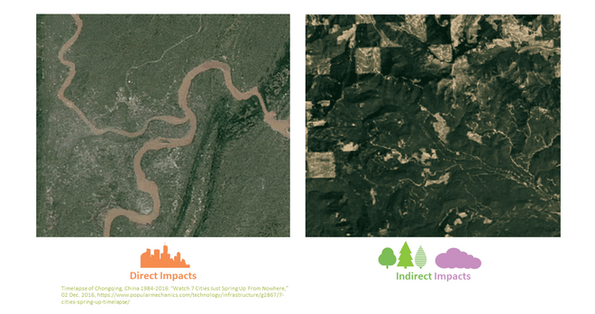
Urban development impacts biodiversity both directly and indirectly.
Examples of how urban development and it's resource consumption destroys and fragments habitats
Motivation: Accessible Ecological Information
1
/2
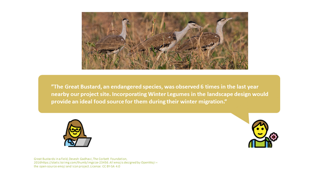
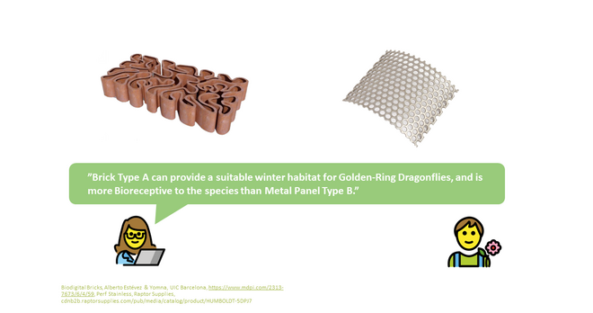
Given more accessible information designers and ecologists can have more collaborative and informed discussions
A Computational Framework
1
/11
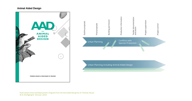
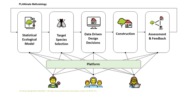
Animal Aided Design by Wolfgang Weisser and Thomas Hauck proposes a conservation focused design methodology
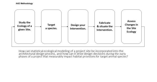
A simplified linear diagram of the Animal-Aided-Design methods
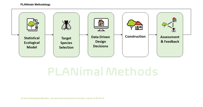
The PLANimal methods augment Animal Aided Design with digital tools, techniques, and tactics.
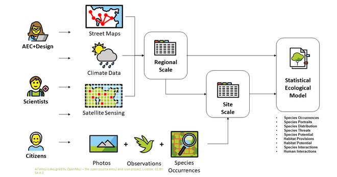
The statistical model is a location specific, multi-scalar, structured collection of geo-spatial ecological information
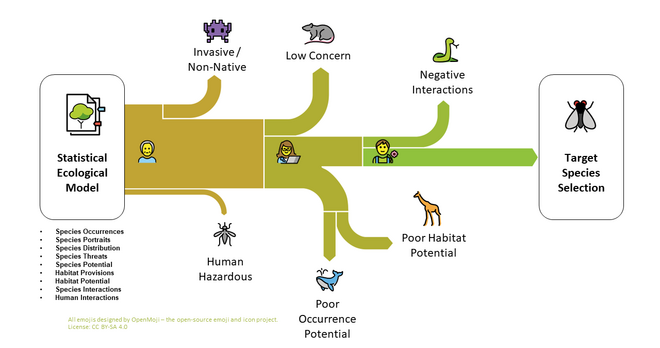
Finding the right species to target for a design relies on applying multiple filters to the regional species pool.
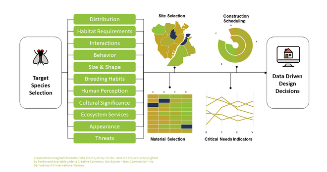
The ecological model provides information on a chosen species, and many of its biological and physical properties.
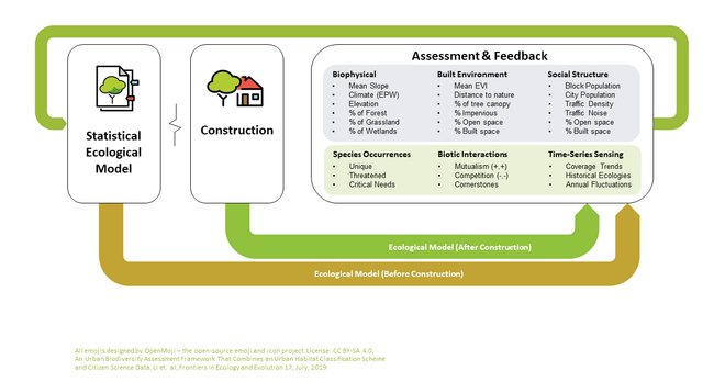
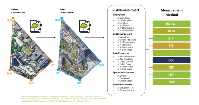
By comparing two ecological models, such as before and after construction, we can measure ecological changes.
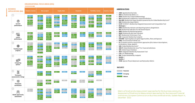
A matrix of biodiversity measurement methods that could possibly implement data from the PLANimal ecological model.
An example of how before / after ecological models of a region can be compared, and the changes applied to a biodiversity index
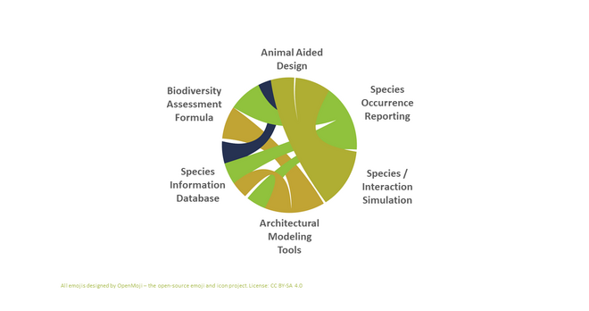
PLANimals connects a fragmented landscape of tools, techniques, and tactics for designing with ecological information.
Ultimately, the PLANimal framework required a central platform to support the framework's various methods.
A Web Platform
1
/14
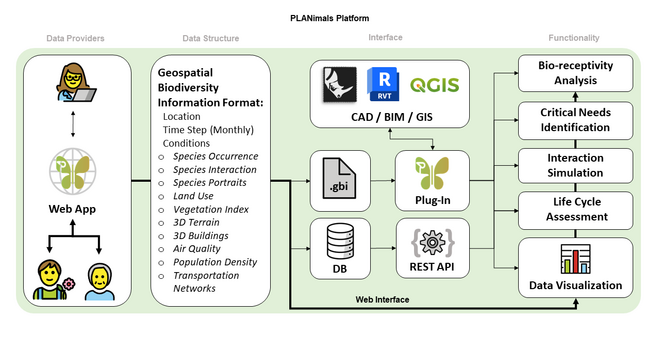
The overall tech concept for the PLANimal platform. Inspired by Ladybug tools, this platform supports multiple interfaces
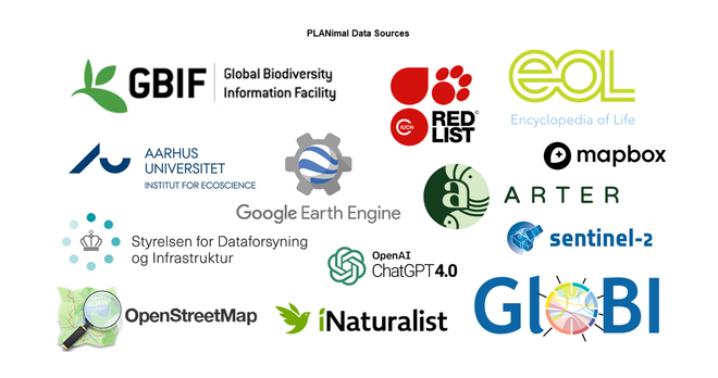
Some of the data providers for PLANimal's web platform, and ecological models.
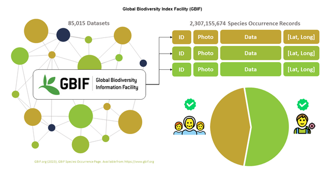
GBIF is a network of Species Occurrence databases, and a very important data source for PLANimal with over 2 billion records.
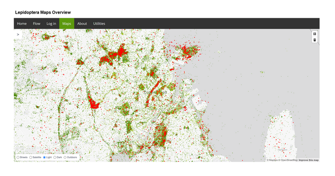
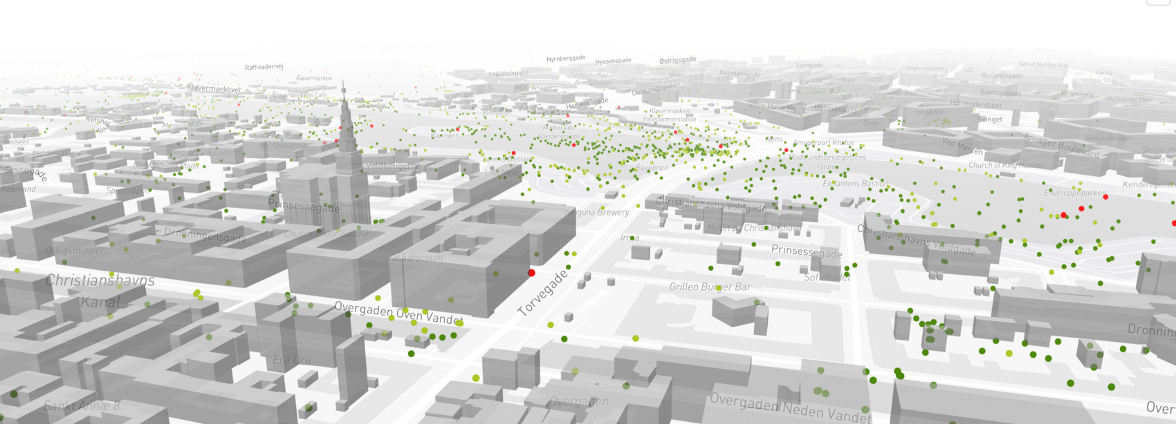
The web platform supports a "slippy" map for exploring, and visualizing ecological data
Any region on the map can be selected with a polygon in order to access that region's ecological data
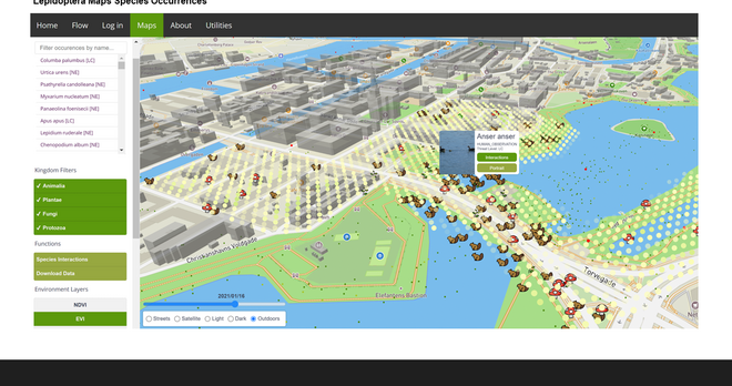
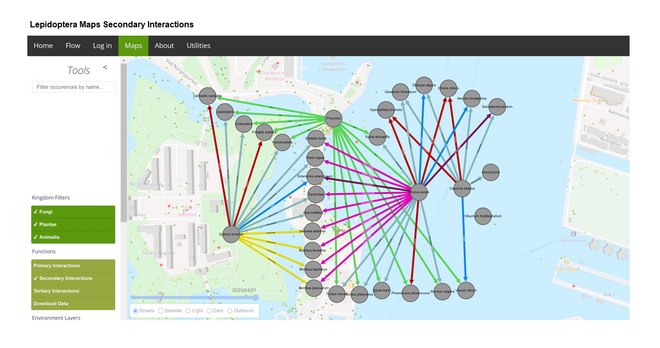
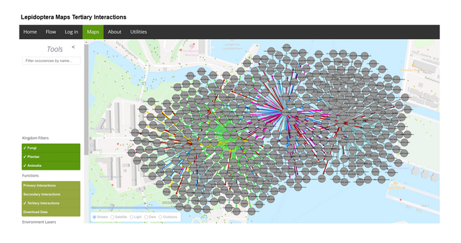
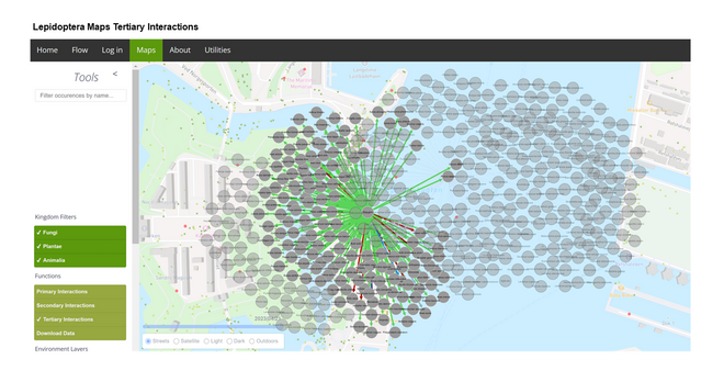
Species interactions for a region can be interactively displayed at multiple relationship levels
Specific species can be selected to highlight only their interactions
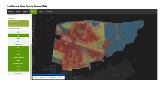
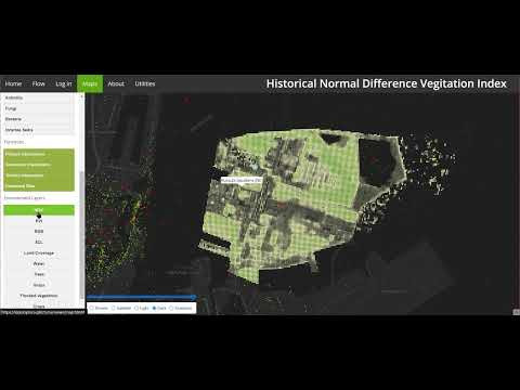
Time series, remote sensed, multi-spectral imagery is available for all queries, giving insight into land cover trends
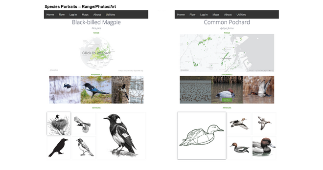
Species portraits contain vital information about any species selected on the PLANimal map
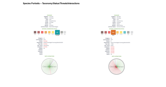
The species portrait contains threat status information to help determine and focus conservation efforts
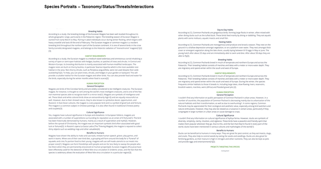
Long form species "Narratives" are available for each species portrait, providing species information not otherwise reducable.
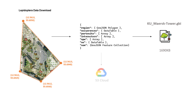
All data for any PLANimal spatial query can be downloaded into a lightweight file
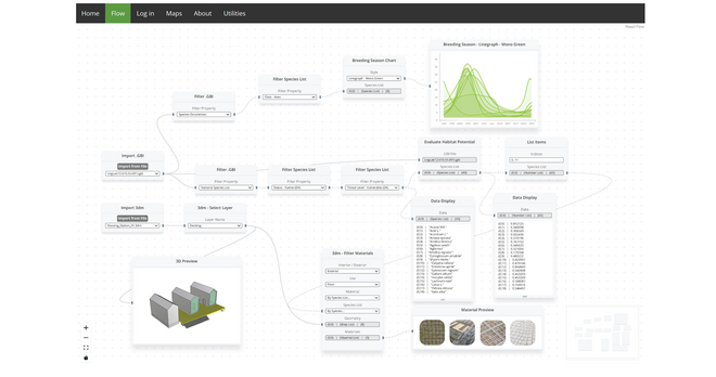
Flow is a web based "Grasshopper" analogous design platform for working parametrically with GBI data.

Det Kongelige Akademi understøtter FN’s verdensmål

Siden 2017 har Det Kongelige Akademi arbejdet med FN’s verdensmål. Det afspejler sig i forskning, undervisning og afgangsprojekter. Dette projekt har forholdt sig til følgende FN-mål


CV